
[ad_1]
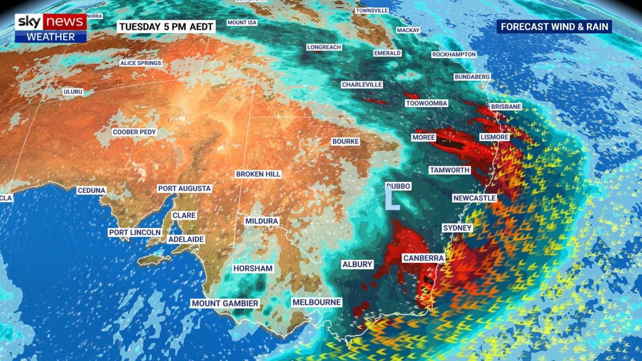
A second major rain event is charging across Australia’s east today where it will meet the trough that’s caused all the weather drama across New South Wales and south east Queensland this week.
A mega rain event will be formed when the two weather systems merge.
Bureau of Meteorology (BOM) forecaster Jonathan How said today would be a “critical day”.
He said areas impacted will include parts of Queensland, NSW, the ACT and even eastern Victoria.
“We’re really concerned about the rainfall from early Tuesday morning into southern Queensland and Brisbane right down the NSW coast and the ACT and central tablelands into Gippsland,” Mr How said.
“There are concerns for heavy rain and the heaviest storms, which could bring thunderstorms.”
It comes a day after Queenslanders experienced torrential rain and flash flooding and entire towns in NSW were forced to evacuate as rivers and creeks swelled then overflowed.
RELATED: Follow the latest flood updates as they happen
A map showing rainfall across large swathes of Australia’s east coast was shared by the BOM in NSW alongside a warning that read: “It may have been going for days but unfortunately this situation is far from over. You can see rain still falling in flood areas, with more forecast for coming days.”
Sky News Weather senior metrologist Tom Saunders said this morning that there was “24 hours of wild conditions left”.
He said the weather event was huge: “This system has impacted the northern tropics, the outback, the eastern seaboard right down to Tasmania”.
In NSW, residents along the Colo River have been told to “prepare to evacuate” by helicopter and boat as “extremely high” record floods threatened the Hawkesbury-Nepean catchment.
In western Sydney, thousands more residents are preparing to evacuate as the Hawkesbury River continues to rise.
And on the mid-north coast, residents of Kempsey spent a second night away from home as the Macleay River threatened to surge again.
In Queensland, beaches are shut, theme parks closed down and the capital drenched with more than 100mm in 24 hours.
All of the Gold Coast’s theme parks were shut on Monday due to flash flooding and dangerous surf conditions shut the region’s beaches.
Further inland from the Gold Coast, Mount Tamborine recorded more than 250mm and footage on social media showed a tiny creek transformed into a torrent of water.
Queensland SES director Brian Cox said Brisbane and the Gold Coast had been the worst hit.
“The emergency warning went out last night to most of the residents in the Gold Coast area; we received over 300 calls for assistance since,” he said.
“There’s also been swift water rescues conducted. We’re also warning our residents that the rain has not stopped, we still have another couple of days to go through.
“What we are prepared for is more rain on its way … there’s quite a few smaller rivers, as well as water across roads. If it’s flooded, forget it.”
Despite Queensland expecting 200mm in some parts of the state over the coming days, Mr Cox said NSW was still worse off.
“I don’t think (we’ll get) as much as NSW,” he said.
“In actual fact, to support this at once we sent a team of 60 down to NSW yesterday.
“We’ve also got another 40-person team ready to deploy to NSW to help them out.
“What we are concerned about here in Queensland is that flash flooding. That’s the highest risk we have.
“The water is saturated from the ground. And we know that there is a significant risk that this very short notice rainfall is ahead of us.”
– with Natalie Wolfe
[ad_2]
Source link